
Contents
- 1 Executive Summary
- 2 1. Introduction to the Yellowstone Volcanic System
- 3 2. Geological History of Yellowstone Eruptions
- 4 3. The Magmatic System Beneath Yellowstone
- 5 4. Current Monitoring and Volcanic Activity
- 6 5. Future Eruption Scenarios and Likelihood
- 7 6. Potential Impacts of a Large Yellowstone Eruption
- 8 7. Preparedness and Mitigation Strategies
- 9 Conclusion
Executive Summary

Yellowstone National Park is home to one of Earth’s largest and most active volcanic systems, widely recognized as a “supervolcano” due to its history of exceptionally powerful eruptions. This report provides a comprehensive overview of the Yellowstone volcanic system, detailing its geological past, current state, sophisticated monitoring efforts, and potential future scenarios. It aims to provide an authoritative and evidence-based understanding, addressing common misconceptions and outlining preparedness strategies.
Yellowstone has experienced three cataclysmic caldera-forming eruptions over the past 2.1 million years, with the most recent occurring approximately 631,000 years ago. These events were orders of magnitude larger than any in recorded human history. Despite popular misconceptions, Yellowstone is not overdue for another supereruption. Volcanic systems do not operate on predictable schedules, and current scientific data indicates the magma chambers beneath Yellowstone are largely solid, lacking the melt fraction necessary for such an event in the foreseeable future. The most likely future volcanic events at Yellowstone are relatively non-explosive lava flows or small-to-moderate hydrothermal explosions, which typically have localized impacts within the park.
The Yellowstone Volcano Observatory (YVO), a consortium of scientific agencies, maintains a robust, multi-faceted monitoring network to detect subtle changes in seismic activity, ground deformation, and hydrothermal systems, providing critical lead time for any significant unrest. While the probability of a supereruption is exceedingly low, its potential regional and global impacts—including widespread ashfall, short-term climate alteration, and agricultural disruption—are significant, underscoring the importance of ongoing research and preparedness planning. In conclusion, Yellowstone remains a dynamic geological area, but continuous, advanced monitoring provides assurance that any significant changes would be detected well in advance, allowing for appropriate response and mitigation. The scientific consensus is that a catastrophic eruption is not imminent.
1. Introduction to the Yellowstone Volcanic System
Yellowstone National Park, a globally renowned natural wonder, harbors one of Earth’s most formidable and active volcanic systems. Its designation as a “supervolcano” is attributed to its capacity to produce eruptions of immense scale, specifically those reaching magnitude 8 on the Volcano Explosivity Index (VEI), which entail the expulsion of over 1,000 cubic kilometers of magma. This geological powerhouse has profoundly shaped the North American landscape over millions of years, leaving an indelible mark on its topography and climate.
The driving force behind Yellowstone’s volcanism is a deep-seated mantle plume, commonly referred to as a “hotspot.” This hotspot has systematically migrated over geological timescales, leaving a distinct trail of progressively older caldera complexes that extend from western Idaho to the current Yellowstone National Park over the past 16.5 million years. This continental hotspot track is a rare geological phenomenon, analogous to the well-known oceanic Hawaiian-Emperor seamount chain, and it vividly illustrates the long-term, migratory nature of this intense magmatic activity.
Within this unique geological setting, the interaction between the hot basaltic magma rising from the mantle plume and the overlying continental crust is critical. The intense heat from the ascending basaltic melts causes the continental crust to melt, generating voluminous rhyolitic magmas. These gas-rich, felsic magmas then accumulate in shallow reservoirs beneath the Yellowstone region, leading to ground doming and the formation of ring fractures on the surface. These shallow magma chambers are the source of the large explosive eruptions that characterize Yellowstone’s powerful volcanic history.
2. Geological History of Yellowstone Eruptions
Yellowstone’s past is punctuated by three exceptionally large explosive eruptions, each of which fundamentally reshaped the region and had far-reaching, continent-wide impacts. These events resulted in the formation of massive collapse calderas, vast basin-shaped depressions created when the ground surface subsides following the withdrawal of magma from beneath.
The earliest of these cataclysmic events, the Huckleberry Ridge Tuff eruption, occurred approximately 2.1 million years ago. This eruption was of unprecedented scale, removing such a vast quantity of magma from its subsurface reservoir that the ground above it collapsed, creating a gigantic depression larger than the state of Rhode Island. Its sheer magnitude is difficult to comprehend, but it was estimated to be about 6,000 times larger than the May 18, 1980, eruption of Mount St. Helens in Washington State.
Later, activity shifted to a smaller region within the Island Park area of eastern Idaho, just southwest of Yellowstone National Park. This led to the Mesa Falls Tuff eruption around 1.3 million years ago, another significant caldera-forming event. This eruption was approximately 700 times larger than the 1980 Mount St. Helens event.
The immense scale of these “supereruptions” carries profound implications. While the 1991 eruption of Mount Pinatubo in the Philippines, which was about 1,000 times smaller than Yellowstone’s largest known eruption, caused temporary yet measurable changes in global temperatures for three years , and the 1815 Tambora eruption (approximately one-tenth the size of a Yellowstone supereruption) led to the infamous “Year Without a Summer” and global food shortages , a Yellowstone supereruption would unleash a level of disruption far exceeding these historical precedents. The sheer volume of material ejected would lead to global systemic impacts on agriculture, infrastructure, and climate, highlighting why such events are subjects of intense scientific scrutiny despite their low probability.
The average interval between these three large explosive eruptions is approximately 725,000 years. However, scientists strongly emphasize that this average is statistically unreliable due to the extremely small sample size (only two intervals) and the inherent unpredictability of volcanic systems. Supereruptions, even when they recur within a volcanic system, do not follow evenly spaced schedules. This scientific understanding directly contradicts the common misconception that Yellowstone is “overdue” for another eruption.
Beyond these cataclysmic events, Yellowstone has a more frequent history of smaller, less explosive eruptions. Since the last giant eruption 631,000 years ago, approximately 80 mostly non-explosive eruptions have occurred. These include at least 27 rhyolite lava flows within the caldera, 13 rhyolite lava flows outside the caldera, and 40 basalt vents outside the caldera. The most recent volcanic activity consisted of rhyolitic lava flows that erupted approximately 70,000 years ago, forming the Pitchstone Plateau in southwestern Yellowstone National Park. Only a few of these post-caldera eruptions had significant explosive components, with the largest occurring about 173,000 years ago, similar in size to the eruption that created Crater Lake in Oregon.
Below is a summary of Yellowstone’s major caldera-forming eruptions:
| Eruption Name (Associated Tuff) | Approximate Date (Million Years Ago) | Relative Size (vs. 1980 Mt. St. Helens) | Key Characteristics/Impacts |
| Huckleberry Ridge Tuff | 2.1 | ~6,000 times larger | Largest eruption; created depression larger than Rhode Island; ash covered much of western North America |
| Mesa Falls Tuff | 1.3 | ~700 times larger | Shifted activity to Island Park area; significant caldera formation |
| Lava Creek Tuff | 0.631 (631,000 years ago) | ~2,500 times larger | Formed the Yellowstone caldera as seen today; ash covered much of western North America |
Table 1: Major Yellowstone Caldera-Forming Eruptions (Past 2.1 Million Years)
3. The Magmatic System Beneath Yellowstone

Yellowstone is underlain by a complex, two-tiered magmatic system, which scientists have meticulously mapped using advanced geophysical techniques. This system is not a single, vast chamber of molten rock, but rather a dynamic mix of melt and solid material.
The shallower rhyolitic reservoir is composed of high-silica rhyolite and extends from approximately 5 km to 17 km (3 to 10 miles) beneath the surface. This body is roughly 90 km (55 miles) long and 40 km (25 miles) wide. A critical characteristic of this chamber is that it is mostly solid, containing only about 5-15% melt. Recent magnetotelluric imaging has further refined this understanding, identifying four distinct rhyolitic reservoirs at shallower depths (4-11 km) within this body. These are described as a “mush of packed crystals interspersed with liquid rhyolitic magma”.
Beneath this shallower system lies the deeper basaltic reservoir, situated from 20 km to 50 km (12 to 30 miles) beneath the surface. This reservoir is composed of low-silica basalt. Although it is approximately 4.5 times larger than the shallow chamber, it contains an even lower percentage of melt, estimated at only about 2%. This deeper basaltic body is considered the fundamental “heat engine” for the entire system, providing the thermal energy that helps generate and sustain the shallower rhyolite magma.
The predominantly solid state of Yellowstone’s magma chambers is a key factor in assessing eruption likelihood. Scientific understanding indicates that melt fractions above 40% are generally necessary to generate sufficient pressure for a volcanic eruption. Given that the shallow rhyolitic chamber contains only 5-15% melt and the deeper basaltic chamber contains only about 2% melt, the current state of the system lacks the necessary volume of connected liquid magma and internal pressure to drive a catastrophic event. This low melt fraction is a primary scientific reason why a large, explosive eruption is not considered imminent or even likely in the near future. This understanding is crucial for dispelling public anxiety and sensationalism surrounding Yellowstone, as the current state of the magma chambers is a direct indicator of the low probability of a supereruption.
Scientists employ advanced geophysical techniques to image and understand these subsurface structures:
- Seismic Imaging: This method involves analyzing seismic waves generated by natural earthquakes or artificial sources (such as vibrating trucks) to map the depth and characteristics of the magma reservoirs. While valuable, seismic data can be influenced by factors like magma temperature, pressure, and volume, which can complicate the precise determination of magma’s spatial distribution.
- Magnetotelluric Imaging: This technique measures the electrical conductivity of subsurface rocks. Molten rock is an excellent electrical conductor, being up to a thousand times more conductive than its solid counterpart, making magnetotellurics an ideal tool for mapping the distribution of melt. Recent studies using this method have provided high-resolution maps, confirming the low melt percentages and revealing the distinct reservoirs within the system.
Recent magnetotelluric imaging has revealed a significant dynamic within the magmatic system: the shallow rhyolitic magma in the western part of the caldera appears to be disconnected from the deeper basaltic heat source. This suggests that the magma in this region will continue to cool over time, leading to a eventual cessation of rhyolitic volcanic activity in the western caldera. Conversely, the northeastern part of the caldera shows a direct connection between shallow rhyolitic magma and the underlying basaltic heat source. This connection implies that this region could sustain and potentially increase its magma volume over hundreds of thousands of years. This observation points to a long-term shift in the potential locus of future volcanic activity within the caldera, illustrating that Yellowstone’s magmatic system is not static but dynamically evolving. Such long-term trends provide a geological “future” for Yellowstone, where volcanism might eventually wane in some areas while persisting or intensifying in others over vast timescales, mirroring the historical migration of the hotspot itself over millions of years. This offers a more nuanced understanding of Yellowstone’s future, moving beyond a simple “will it erupt or not?” to “where and how might it evolve over geological timescales?”
A summary of the Yellowstone magma chamber characteristics is provided below:
| Reservoir Type | Approximate Depth Range (km/miles) | Approximate Dimensions (Length x Width in km/miles) | Composition | Estimated Melt Percentage | Primary Role/Significance |
| Shallow Rhyolitic | 5-17 km (3-10 mi) | 90 km (55 mi) x 40 km (25 mi) | High-silica rhyolite | 5-15% | Source of large explosive eruptions; mostly solid “mush” |
| Deeper Basaltic | 20-50 km (12-30 mi) | ~4.5 times larger than shallow chamber | Low-silica basalt | ~2% | “Heat engine” sustaining shallower rhyolite magma |
Table 2: Yellowstone Magma Chamber Characteristics
4. Current Monitoring and Volcanic Activity
The Yellowstone Volcano Observatory (YVO) plays a critical role in safeguarding the region by continuously monitoring the Yellowstone volcanic system. YVO is a vital consortium comprising nine Federal, State, and academic agencies, whose collective mission is to provide timely monitoring and hazards assessment of volcanic, hydrothermal, and earthquake activity within and around Yellowstone National Park. Beyond monitoring, YVO conducts essential research into magmatic processes and issues warnings and guidance related to potential future geological hazards. To ensure effective response during crises, YVO regularly updates its comprehensive response plans.
YVO employs a sophisticated, multi-faceted network of instruments to detect even the most subtle changes that could indicate volcanic unrest:
- Earthquake Monitoring: Yellowstone is one of the most seismically active areas in the United States, experiencing an average of 1,500 to 2,500 located earthquakes per year. The Yellowstone Seismic Network (YSN), operated by the University of Utah Seismograph Stations (UUSS), consists of approximately 50 seismometers capable of detecting even the smallest tremors; over 99% of these earthquakes are magnitude 2 or below and are not felt by humans. It is important to note that these earthquakes are primarily “brittle-failure events,” caused by the breaking of rocks due to crustal stresses, rather than direct movement of magma.
- Deformation Monitoring: Ground movement provides crucial insights into subsurface processes. YVO relies heavily on Global Positioning System (GPS) stations, strainmeters, and tiltmeters to monitor subtle ground deformation, such as uplift or subsidence. While small ground movements are a common occurrence and do not inherently signify an impending eruption, rapid or intense deformation would be a significant precursor to a larger event.
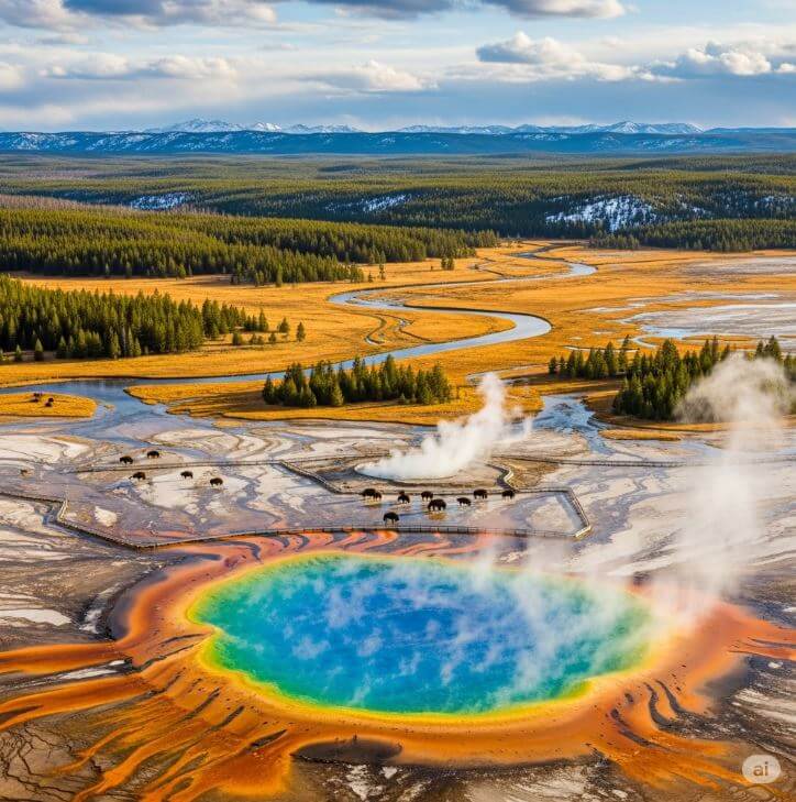
- Hydrothermal Monitoring: Yellowstone’s world-famous geysers, hot springs, and fumaroles are direct manifestations of its active hydrothermal system, which is intimately linked to the underlying magmatic heat. YVO monitors changes in streamflow, selected stream temperatures, and utilizes continuous infrasound monitoring to detect shifts in hydrothermal activity. Hydrothermal explosions, though typically small, are a regular occurrence, happening every few years and forming craters a few meters across. Larger hydrothermal explosions, capable of forming craters up to a few hundred meters across, occur every few thousand years. These events are generally localized within the park boundaries.
A critical aspect of volcano monitoring at Yellowstone is the establishment of comprehensive baseline data to understand “normal” activity. The monitoring networks have been significantly upgraded over the years, particularly since 1995, allowing for the detection and location of more earthquakes, especially smaller magnitude events. This long-term, high-resolution baseline data is indispensable for scientists to differentiate routine geological processes from genuine signs of unrest. For instance, the thousands of small earthquakes and instances of ground deformation that occur annually are part of Yellowstone’s typical background activity and are not indicative of an impending eruption. The continuous improvement of the monitoring network enables scientists to reliably identify “unusual” behavior, which serves as the true indicator of potential changes in the volcanic system. This ability to distinguish between normal fluctuations and genuine precursors is paramount for accurate hazard assessment and effective public communication, preventing undue alarm from commonplace geological events.
The table below summarizes the key monitoring methods employed by the Yellowstone Volcano Observatory:
| Monitoring Technique | Specific Instruments/Methods Used | What it Measures/Detects | Significance for Hazard Assessment | Frequency/Volume of Data |
| Earthquake Monitoring | Seismometers (Yellowstone Seismic Network – YSN) | Ground motions, hypocenter/epicenter location, earthquake swarms | Detects crustal stresses and potential magma movement; distinguishes normal activity from unrest | 1,500-2,500 earthquakes/year; continuous real-time data |
| Deformation Monitoring | GPS stations, Strainmeters, Tiltmeters | Subtle uplift or subsidence of the ground surface | Indicates changes in subsurface pressure from magma or hydrothermal fluids | Continuous data; highly sensitive to ground movement |
| Hydrothermal Monitoring | Streamflow/temperature sensors, Infrasound monitoring | Changes in hot spring/geyser activity, gas release, steam explosions | Reflects interaction between magma heat and water systems; detects localized explosive events | Continuous data; detects activity not visible to the eye |
Table 3: Yellowstone Volcano Observatory Monitoring Methods
5. Future Eruption Scenarios and Likelihood
A persistent public misconception is that Yellowstone is “overdue” for a supereruption. This notion often arises from calculating an average interval between past major eruptions (approximately 725,000 years) and noting that the last such event occurred 631,000 years ago. However, this statistical interpretation is fundamentally flawed. Volcanoes do not erupt on predictable schedules, and an average derived from only two past intervals is scientifically meaningless. The concept of “recurrence interval” provides a historical context for the potential scale of eruptions, but it does not dictate future timing. Volcanology focuses on understanding probabilities and recognizing precursors, rather than precise timing predictions. The scientific community explicitly states that volcanoes “do not work in predictable ways”. The average recurrence interval is merely a descriptive statistic of past events, not a predictive tool for future ones, especially with such a small sample size. Therefore, the focus remains on the current state of the magmatic system and real-time monitoring data, rather than historical averages, to assess immediate risk. This understanding is crucial for managing public expectations and preventing undue alarm.
Based on current scientific understanding, the probability of another catastrophic caldera-forming eruption at Yellowstone is exceedingly low. Scientists are not convinced that such an event will ever happen again. The primary reason for this assessment lies in the state of the magma chamber: the shallow rhyolite magma chamber is only 5-15% molten, which is likely insufficient to feed a supereruption. As previously discussed, melt fractions above 40% are generally necessary to generate enough pressure for a volcanic eruption. Consequently, the chances of a large, caldera-forming eruption occurring at Yellowstone are considered “exceedingly small in the next few thousands of years”.
If Yellowstone does erupt again, it is far more likely to be a smaller, less explosive event than a supereruption. The most probable future eruption scenarios include:
- Hydrothermal Explosions: These are “rock hurling geyser eruptions” that occur every few years, forming craters a few meters across within Yellowstone National Park. Larger hydrothermal explosions, capable of forming craters up to a few hundred meters across, occur every few thousand years. These events are localized and primarily pose hazards within the park boundaries.
- Lava Flows: Non-explosive rhyolitic lava flows are also a highly likely scenario, similar to the most recent volcanic activity that occurred 70,000 years ago and formed the Pitchstone Plateau. Such lava flows would have minimal direct effect outside Yellowstone National Park.
There is a significant discrepancy between public perception and scientific reality regarding Yellowstone’s volcanic activity. The media often sensationalizes Yellowstone as a “supervolcano” poised for global catastrophe, leading to widespread anxiety. However, the scientific data clearly demonstrates a spectrum of activity, with smaller, localized events being far more common and likely than a supereruption. While the theoretical potential for a supereruption exists on geological timescales, the imminent risk is dominated by these smaller, more frequent events that pose hazards primarily within the park boundaries. Understanding this spectrum of activity is vital for accurate risk assessment and for guiding public preparedness efforts toward the most probable scenarios.
While a supereruption is highly unlikely in the foreseeable future, the science of volcanic eruption forecasting has advanced significantly. Scientists expect that the buildup preceding any catastrophic eruption would involve intense precursory activity, far exceeding normal background levels, at multiple locations within the Yellowstone volcano. These precursors would include strong earthquake swarms and rapid ground deformation. Such significant changes would be detectable for weeks, months, or perhaps even years in advance, providing crucial lead time for hazard mitigation and evacuation planning.
6. Potential Impacts of a Large Yellowstone Eruption
Should another large, caldera-forming eruption occur at Yellowstone, its effects would be profound and extend globally, though the immediate and most devastating impacts would be regional.
Regional Impacts: Areas closest to Yellowstone, particularly parts of Montana, Idaho, and Wyoming, would be directly affected by pyroclastic flows. These are fast-moving, extremely hot mixtures of volcanic ash, incandescent gas, and near-molten pumice fragments that hurtle outwards in all directions, capable of destroying all life and structures in their path. The immediate vicinity of the eruption would be leveled, and any human-made structures completely demolished, with severe structural damage extending for hundreds to thousands of square kilometers.
Beyond the immediate blast zone, ashfall would cover vast areas of North America. New scientific models predict that a supereruption would generate an “umbrella” ash cloud, which expands evenly in all directions, largely unaffected by prevailing winds, resulting in a bull’s-eye pattern of deposition. This means:
- Cities within 500 km (311 miles) of Yellowstone, such as Billings, Montana, and Casper, Wyoming, could be covered by more than a meter (a few feet) of ash.
- Upper Midwestern cities, including Minneapolis, Minnesota, and Des Moines, Iowa, would receive centimeters (inches) of ash.
- Cities on the East and Gulf coasts, such as New York and Washington, D.C., would receive millimeters or less (fractions of an inch).
While ashfall on the far side of the continent might be measured in millimeters, even these seemingly small accumulations can have severe consequences. Infrastructure damage would be widespread; reduced traction on roads, shorted-out electrical transformers, blocked sewer and water lines, and damage to buildings due to the weight of accumulated ash are all projected outcomes. Electronic communications and air travel would be severely disrupted or entirely shut down across the continent.
Agricultural disruption would be catastrophic. Thick layers of acid ash would devastate crops over millions of square kilometers, leading to widespread crop failure, disruption of livestock production, and potential food shortages or famine.
Health hazards from volcanic ash are significant. Fine ash particles pose severe respiratory risks, causing acute symptoms from heavy exposure. Additionally, ash can contaminate water supplies. The immediate vicinity could also experience noxious fumes and “toxic fog”.
The following table illustrates simulated ashfall depths from a hypothetical supereruption:
| Location Type/Example | Estimated Ash Depth | Primary Impacts at this Depth |
| Within 500 km (e.g., Billings, MT; Casper, WY) | >1 meter (few feet) | Complete destruction of structures, extermination of most life, severe infrastructure damage |
| Upper Midwest Cities (e.g., Minneapolis, MN; Des Moines, IA) | Centimeters (inches) | Major agricultural disruption, building damage, blocked utilities, respiratory issues |
| East/Gulf Coasts (e.g., New York, Washington D.C.) | Millimeters (fractions of an inch) | Reduced road traction, shorted electrical transformers, respiratory problems, aviation disruption |
Table 4: Simulated Ashfall Depths from a Supereruption
Global Impacts: A catastrophic Yellowstone eruption would have worldwide effects, primarily through its impact on the Earth’s atmosphere and climate. The eruption would inject massive amounts of fine ash and gases, particularly sulfur dioxide, high into the stratosphere, reaching altitudes of 30-50 km, three to five times higher than most commercial jets fly. This material would form a large volcanic cloud that would drift around the world. The sulfur dioxide would react with atmospheric water vapor to form sulfuric acid aerosols, leading to a significant drop in global temperatures for years to decades.
Predictions suggest a global average temperature fall of up to 4°C (7°F), with land temperatures dropping by up to 7°C (13°F), and central North America experiencing a severe cooling of more than 10°C (18°F). Historical parallels underscore the severity of such climate alteration: the 1815 Tambora eruption, while only about one-tenth the size of a Yellowstone supereruption, caused the “Year Without a Summer” in 1816, leading to widespread crop failures and global food shortages. The ash cloud would also cause significant atmospheric opacity, reducing sunlight and severely impacting growing seasons worldwide.
The impacts described above are not isolated events but rather interconnected elements within a complex cascade. For example, ashfall damages critical infrastructure, which in turn disrupts transportation and communication networks, severely hindering aid efforts and economic activity. The resulting climate cooling directly leads to widespread crop failure, which then triggers food shortages and, potentially, famine. Simultaneously, widespread respiratory illness strains healthcare systems. This illustrates how a single geological event can trigger a series of environmental changes that then propagate through and severely disrupt human systems, including agriculture, infrastructure, public health, and the global economy. The global nature of these impacts highlights the profound interconnectedness of modern civilization and its inherent vulnerability to large-scale natural disasters. Therefore, preparedness efforts must extend beyond local or regional considerations to encompass global supply chains, international aid mechanisms, and strategies for long-term societal resilience.
7. Preparedness and Mitigation Strategies
While the probability of a catastrophic Yellowstone eruption is exceedingly low, the Yellowstone Volcano Observatory (YVO) maintains comprehensive and regularly updated response plans for all geological hazards, including earthquakes, hydrothermal explosions, and potential volcanic eruptions. These plans are meticulously aligned with procedures established by the USGS Volcano Science Center and define critical functions such as data management, communications, monitoring, scientific analysis, and logistical support that would be scaled up during a crisis. YVO’s protocols differentiate between sudden “events,” like the hydrothermal explosion at Biscuit Basin on July 23, 2024, which prompt immediate additional monitoring and hazard communication, and slowly evolving “activity with potential,” such as the 2003 thermal event at Norris Geyser Basin, which requires intense, prolonged monitoring.
- Staying Informed: Sign up for local government emergency alerts and closely monitor information from local officials and the USGS nationwide volcano alert system.
- Developing Communication Plans: Create a support team, plan how to reconnect with loved ones if separated, and designate an out-of-town contact, as it may be easier to reach individuals outside an affected area.
- Evacuation Planning: Have a household evacuation plan, including knowing multiple routes and destinations, and planning for pets and livestock. Following recommended evacuation routes is crucial for safety from blasts, debris, hot gases, mudflows (lahars), and lava flows.
- Health Protection: Prepare to protect health from ash, volcanic smog (vog), and volcanic glass. This includes limiting time outdoors, closing windows and doors, using indoor air cleaners, and having N95 masks (which protect against ash but not gases) and goggles. Avoiding driving during ashfall is advised due to reduced visibility, slippery surfaces, and potential engine clogging.
- Gathering Emergency Supplies: Assemble a “Go-Kit” with at least three days of essential supplies (food, water, medications, chargers, flashlights, copies of important documents) that can be carried easily. A “Stay-at-Home Kit” should contain at least two weeks of supplies. Ensure a 1-month supply of medication and keep personal, financial, and medical records safe and accessible. Gas masks and air filters are also recommended for each family member, including child-sized masks if necessary, as volcanic smoke and ash particles are dangerous to breathe.
- Avoiding Hazards: Stay upwind of ash plumes and away from river valleys, as lahars (fast-moving mud, rock, and water flows) can rush down valleys.
Practicing evacuation drills and knowing multiple routes out of one’s neighborhood, town, and region are vital. Having local and distant evacuation destinations, along with copies of all crucial identification and paperwork in a “go-bag,” is essential, as return to home may not be possible for an extended period.
Conclusion
Yellowstone National Park is indeed a “supervolcano,” a term reflecting its history of exceptionally powerful, caldera-forming eruptions that have occurred approximately 2.1 million, 1.3 million, and 631,000 years ago. These events were of a magnitude far exceeding any in recorded human history, capable of altering continental landscapes and global climate.
However, scientific evidence consistently demonstrates that Yellowstone is not “overdue” for another catastrophic eruption. Volcanic systems do not operate on predictable schedules, and the average recurrence interval derived from only two past events is statistically insignificant. Crucially, geophysical imaging reveals that the magma chambers beneath Yellowstone are largely solid, with melt percentages far below the threshold required to generate a supereruption. The current state of the system indicates that a catastrophic event is exceedingly unlikely in the foreseeable future.
Instead, the most probable future volcanic activities at Yellowstone are smaller, localized events: non-explosive lava flows and hydrothermal explosions. While these events can still pose hazards within the park, their direct impact would be minimal outside its boundaries.
The Yellowstone Volcano Observatory (YVO) maintains a sophisticated and continuously improving monitoring network that tracks seismic activity, ground deformation, and hydrothermal changes. This comprehensive monitoring allows scientists to distinguish between normal background geological processes and any genuine signs of volcanic unrest. Should a large eruption ever become imminent, the buildup of precursor activity would be detectable for weeks, months, or even years in advance, providing critical lead time for hazard mitigation and public safety measures.
While the remote possibility of a supereruption necessitates ongoing research into its potential regional and global impacts—including widespread ashfall, severe agricultural disruption, and significant short-term climate alteration—the scientific consensus remains clear: a catastrophic eruption is not imminent. Continuous monitoring, coupled with public awareness and general emergency preparedness, provides the most effective strategy for managing the dynamic geological environment of Yellowstone.
>>>Read more Are Yellowstone Park Animals Leaving? A Deep Dive into Nature’s Unfolding Mystery